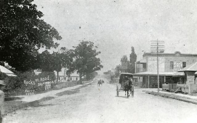
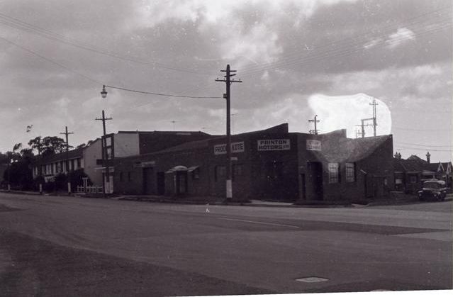
In these days of concrete and bituminous-surfaced roads a journey from Kogarah to Sydney is one devoid of difficulty and may be accomplished in quick time. Before the constitution of the Main Roads Board in 1925, or up to the time that the Board reconstructed Cook’s River Road, the condition of that road was atrocious – it was little more than a right-of-way. Mud alternated with dust as the weather was wet or fine or the Municipal water-cart was in use, while potholes were as plentiful as holes in a collander. Motorists locked upon most of our roads as a “nut and bolt or spare part department” owing to the number of fragments of motor vehicles to be encountered along our thoroughfares. This state of affairs was thought to be a disgrace to those supposedly in charge of the upkeep of our roads, but even this rough condition of the highways was far superior in that which was encountered by the pioneers of the district. There was a time when the only means of reaching Sydney from Kogarah was by way of Punch Bowl (now spelt Punch- bowl) Road, through Enfield to Liverpool Road – a lengthy journey compared with that of today via Prince’s Highway or General Holmes Drive along the foreshores of Botany Bay. The cause of this long journey of years ago was the absence of trafficable roads and the fact that Cook’s River had to be forded. Early records contain the information that “the first bridge across Cook’s River ‘lower down’ was Thompson’s Bridge, built by Mr. Thompson, a solicitor, some 60 years ago (about 1830), which was afterwards replaced by Undercliffe Bridge.”

Commenting on the transport difficulties between Kogarah and Sydney some 74 years ago, a writer stated that “like most of the suburbs of Sydney, Kogarah has suffered severely from want of good roads and consequent means of communication with the city.” In early times residents were compelled to head Wolli Creek and Cook’s River, and to get to Sydney by way of Canterbury or Enfield, and thence on the Parramatta or Liverpool Roads. Even by taking this round-about say, it was very difficult to get through the bush with vehicles, and most of the carriage was done by means of pack-horses. An occupant of Sans Souci at Rocky Point House, who established a still, carried the liquor he manufactured in kegs slung on each side of a pack-horse, and covered the kegs with bags and rushes. The Rocky Point Road is said to have been first cleared by order of Governor Gipps who was in office from 1838 to 1846, Sir George seems to have taken a deep interest in the morals of the settlers. He frequently attended service at Sr Peter’s Church, and one day, when he met Mr. Robert Cooper, of Rocky Point House, he said, “How is it I’ve not seen you at church recently?” Mr. Cooper explained that it was almost impossible to get through the scrub. “Pooh” returned his Excellency, ‘that is no excuse. Here, take this order and get some men from the stockade to clear a truck; and don’t let me have to complain of your absence again.” As a result a track was cleared from the Cook’s River dam to Rocky Point (Sans Souci) to enable Mr. Cooper and his family to go to church. For many years there was merely a bush track, in some places almost impassable for vehicles. At a ridge known as Cobbler’s Pinch (the steep pinch on Prince’s Highway between Kogarah and Cook’s River, generally known as Arncliffe Hill), carts, gigs, etc., had to skirt the ridge, and wind in and out among the rocks and scrub for a mile or more until the obstruction was passed, and then make their way back to the cleared track.

The first to cross Cobbler’s Pinch with a vehicle is said to have been Mr. Berghofer, who went from Sydney to take possession of his farm with a German waggon and four horses about the year 1862. Mr. Berghofer found it impossible to follow the winding of the track round the ridge with such a team and therefore he decided to attempt to make his way over the pinch. In this he was successful, but be met with misfortune further along the road when his waggon capsized owing to a wheel of the vehicle going into a hole. From Mr. Berghofer’s experience it would appear that the dreaded Cobbler’s Pince was not much worse to negotiate than the road itself.
Road Trusts and Toll Bars
Before the advent of municipal government the roads were under the control of Roads Trusts. The first of these Trusts was formed under the Parish Roads Act (4 Victoria, No.12), passed by the Governor-in-Council in 1840. It provided that trustees night be elected for three years, and that these trustees should have power to erect toll bars and levy tolls. It also provided that a rate not exceeding 6d. per acre might be struck on all lands within a distance of three miles of a road. The permissive principle in vogue to a large extent in early years of the colony appears to have been the base of legislation in New South Wales from the first establishment of local government in the colony. The Parish Roads Act might have formed a good basis for a more complete local government measure, but for the fact that all its provisions depended on the word “may” instead of “shall”. The Rocky Point Road Trust, which was almost the only one in the colony which attempted to carry out the provisions of the Act, found that the rate of 6d per acre could not be enforced, as the Act no means of compelling defaulters to pay. The want of roads in the district, however, was so great that the majority of the residents in Kogarah did not raise any dispute against the rate, which they might have done had they taken legal opinion as to the wording of the Act, and, therefore, this Act remained in force in the district long after the levying of rates by similar trusts elsewhere had been abandoned. The first road trust for this district consisted of Messrs. J. B. Carroll (Chairman), Patrick Moore, J. Moore, William Beehag, and James Beehag. The first Government vote for our roads was dated May 20, 1864, and was for £60.
Before this grant for roads was given, however, a toll had been established by the road trust near the Cook’s River dam, and the money collected had been expended principally in cutting down and levelling the huge rocks on top of Cobbler’s Pinch, and in building a bridge over Muddy Creek (on Prince’s Highway between Kogarah and Rockdale). This bridge was opened on February 20, 1862. It was composed of large logs with smaller logs or saplings laid across and covered with earth and stones. The building of this bridge marked the abolition of one of the difficult places to negotiate on the road from Sydney to Kogarah, and today is an up-to-date structure, it having been rebuilt in 1933 by the Main Roads Department after having been practically swept away by an unusual rainstorm during the year. A road committee was formed in the early days of the district in connection with Kogarah Road, which branches off Rocky Point Road, where for many years a license was held for the Prendergast’s Inn, and ran to the punt at Tom Ugly’s Point. Kogarah Road and Rocky Point Road are now known as Prince’s Highway, the only portion of Rocky Point Road now bearing that name leaving Prince’s Highway at Moorefield Racecourse and extending to Rocky Point, Sans Souci. The site of Prendergast’s Inn was in the vicinity of Moorefield Racecourse. The Kogarah Road Committee consisted of Matthew Carroll Patrick Moore, and Joseph Clarke, and the first Government vote of £35 for making and repairing the road was granted on October 3, 1860.

A dispute arose in 1869 between residents along Forest Road and the Rocky Point Road Trust, the residents claiming £100 from the toll receipts for making their road. The residents on the Muddy Creek Road not to be outdone, claimed £50 for their road, and as the trustees could not see their way to divert these large sums of money (a large amount in those days) from the use for which they had been collected, the dispute waxed warm, and resulted in the toll being abolished at Cook’s River Dam by Mr. William Forster (Minister for Lands in the Fifth Cowper Ministry). Determined not to be deprived of such an easy means of revenue, a toll was shortly afterwards opened on Rocky Point Road south of Cobbler’s Pinch, or near where Spring Street, now joins Prince’s Highway. This new position for a toll bar thus allowed traffic using Forest Road to go free as the toll was situated a little beyond Forest Road towards Kogarah, and thus residents of the latter road were not in any way entitled to any of the revenue collected.
The road trust was abolished in 1876, the last trustees having been Messrs. J. B. Carroll, Joseph Twiss, Thomas Mascord, James Hirkey, and William Bush. Mr. Samuel Schofield served three years on the Trust, and other gentlemen were elected and served for longer or shorter terms. Mr. J. B. Carroll was also one of the trustees of the road from the southern side of Georges River to Bottle Forest.
This article was first published in the June 1964 edition of our magazine.
Browse the magazine archive.

