by Gifford and Eileen Eardley
This is an account of a motor coach journey, made by members and friends of the St George Historical Society to follow the Great Western Highway from its junction with Church Street at Parramatta to the Vale of Clwydd at Little Hartley and onwards to Hartley Vale. Its purpose was to inspect the former sites of the old-time inns which once lined the road in the early days. A few of the buildings still remain in-situ, but many have disappeared from our ken. Our listing may be far from complete as a detailed study has not been made by the authors on this interesting subject, but in the course of much wandering over the area oddments of information have come to hand from many sources, and this knowledge forms the basis of the essay.
The Great Western Highway, to all intents and purposes, is a continuation of George Street, Sydney, under the guise of the Parramatta Road, turning north towards Parramatta as Church Street (Granville) for about 800 metres before turning westward as its title defines. Climbing May’s Hill a wide expanse of country, largely devoted nowadays to suburban housing, is to be discerned, reaching to Liverpool in the far distance. On the northern side of the highway, a short distance beyond the Greystanes Road intersection (leading in from the south) is the Fox Hills Golf Course, placed near the junction of the old established Blacktown Road. Here was sited the ancient coaching hostelry named “The Fox Under the Hill”, built in the 1820s by Francis Peisley, and rebuilt in 1830 after a fire. This place was an inn with a true English flavour and important as a horse-changing station when the coaches traversed to Great Western Road. The building stood opposite to, and on the western side of the present Fox Hills Golf Club House. Why these people saw fit to have such an historic building demolished cannot easily be explained as they used it as their headquarters for many years.
With a small degree of imagination one can picture the arrival of the dusty “four-in-hand” coaches, either outward or inward bound, with their complement of cramped and equally dusty passengers, eager for refreshment and the comforts of the inn. The driver no doubt, would head for his foaming tankard or perhaps two, whilst the hostler would unharness the sweating horses, talking to them in a language which horses understand. Meanwhile, the stable-hand would appear with a new team ready, if not willing, to take the coach and its complement over the bumpy and rutty roads which lay ahead.
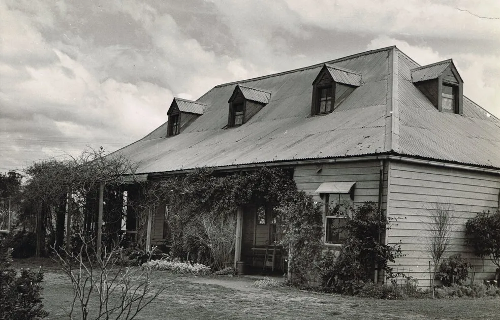
The old inn premises, when first seen by the writers, were well set back from the road and surrounded by an old style post and rail fence and entered through a gateway supported by staunch posts. Although the main portion of the brick building was single storied there was a cluster of small bedrooms each with its dormer window grouped beneath the steeply sloping roof, the latter one may presume, was originally covered with wooden shingles and later replaced with corrugated iron. At each end of the entrance verandah which faced towards the east was a small enclosed room, often used as a bedroom for the more important overnight guests. After the closure of the place as a hotel, presumably about 1912, the Fox Under the Hill seems to have had a chequered existence until such time as it became the headquarters of the golf club. Unfortunately when the present “ten-a-penny” clubhouse was built about 1963, this fine historic inn was ruthlessly demolished. That it was amongst the last of the one-time coaching inns in the vicinity of Sydney was of no significance whatever.
The surrounding wide expanse of grassland in the immediate district of Toongabbie includes the site of the Government Farm established in 1788 by Governor Arthur Phillip for housing newly arrived convicts. The place was noted for its unmitigated brutality, the outcast men being fed once daily at about 7 pm. Only the wellbeing of the farm was considered important and the mortality amongst the unfortunate men, unused to the heavy clearing and ploughing work, can only be described as appalling.
West of the Blacktown Road intersection and on the left hand side of the highway is the old established but almost completely modernised Prospect Hotel, sited almost at the eastern foot of Prospect Hill. One of the foibles of the early road makers was to ascend and descend any hill, no consideration being given to the animal power involved in haulage duties. In fact, gangs of women were at one time engaged in bringing loads of bricks from Brickfield Hill to build the homestead known as Bungarribee House in the vicinity of Blacktown. Nearing the crest of Prospect Hill glimpses may be obtained at intervals, on the left hand side, of the vast expanse of Prospect Reservoir, which is such an important unit of the Sydney Metropolitan Water Supply.
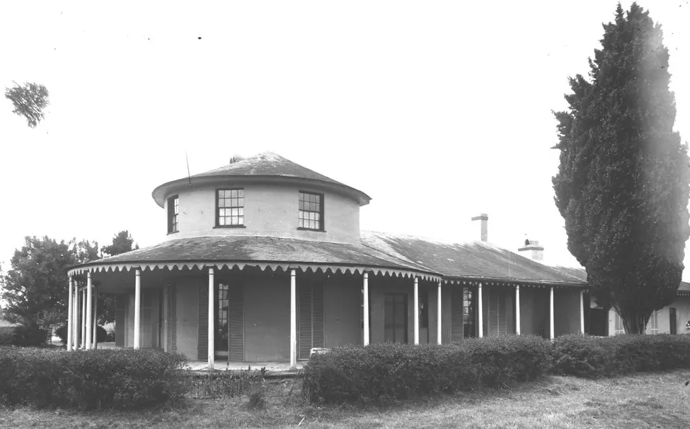
The original route of the Cowpastures Road leading southwards to Narellan joined with the Great Western Road at the crest of Prospect Hill, its alignment passing through the area which was later submerged by the waters of the Prospect Reservoir. On the right hand side, prior to the junction of Church Lane, is the two-storied residence which in former years did duty for man and beast as the Cricketer’s Arms. Looking northwards along Church Lane is the now abandoned Saint Bartholomew’s Church of England which dates from 1841; surrounded by its graveyard ranged along the upper slope of the ridge. This area dates back as far as 1791.
In the vicinity of Eastern Creek a lone spindly cypress tree stands beside the right hand side of the highway. This is the sole relic of an old-time homestead known as “Hollingsworth”, at one time the home of the Learmonth family. The place was distinguished by its beautiful exotic tree growth, one particularly fine example of a Himalayan Cedar was growing within the property against the roadside. With the widening and duplication of this section of the highway it became necessary to demolish the ancient homestead and a plea was sent to the Main Roads Board to preserve this beautiful tree. Unfortunately this was described in the letter as a cypress, which explains the spindly example now marking the site, the real beauty, which need not have been touched in the width of the median strip was felled by the iconoclastic road engineers as being of no consequence.
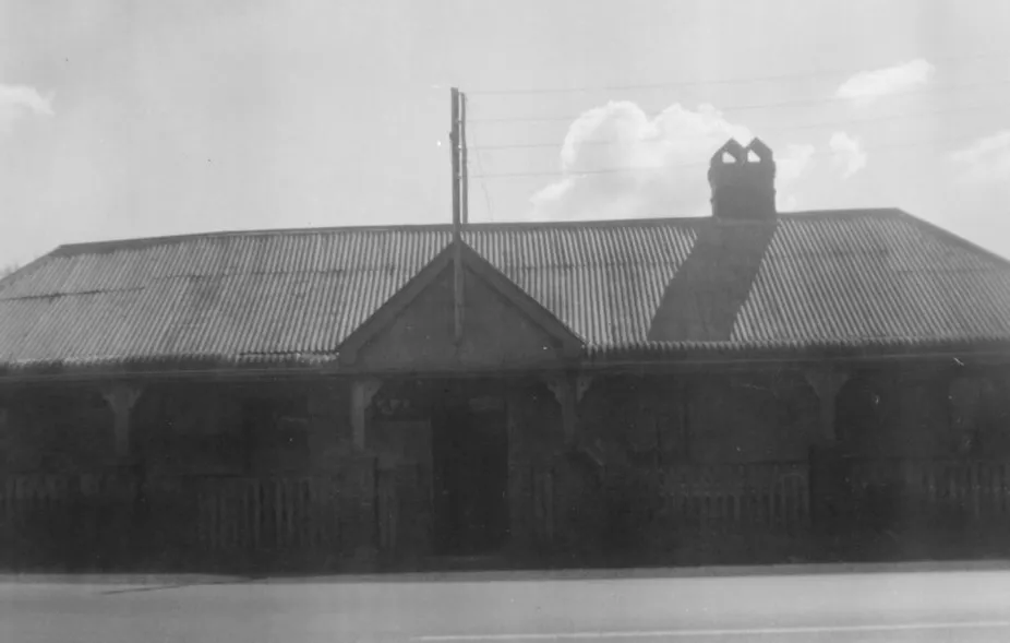
Unfortunately details are not to hand concerning the location of “The Corporation”, an inn under the management of a gentleman known as “Lumpy Dean”, at Minchinbury. Nearby was “The Wainwrights” which, according to report, was distinguished by a swinging sign outside the premises. The fortunes of these two places in their latter days is obscure but it is possible that both faded out through lack of business with the coming of the Great Western Railway. It would appear that for a year or so the line terminated, as far as passenger services were concerned at Mount Druitt, where the horse coaches for destinations further west met the trains.
There were many primitive little cottages strung out along the roadside, some of great age having slab walls and shingled roofs, but these have been largely swept away within recent years. On the right hand side at Colyton it is somewhat difficult to locate the site of the “Red Cow Inn”, a single storied “twin” cottage which was built in 1856 by Thomas Smith. With the coming of the Great Western Railway the place largely lost its business as a coaching inn where the horses were changed, after trotting merrily from the aforementioned “Fox Under the Hill”. The horse pond was, at least until recently, placed at the eastern side of the timber building. The licence was transferred to the “Red Cow Hotel” sited at the southern side of the Penrith Railway Station. After being delicenced, the old building at Colyton served as a school and in more recent times as the Colyton Post Office and also as a general store, kept by a very nice old lady. With the road widening the premises were demolished, later than 1960.
South Creek, now known as St. Marys, was extremely popular with teamsters and drovers who pitched camp by the stream where water and grass was available in good supply for the animals. We have records of two hotels at this place, there may have been more, the first known as William Byrne’s Hotel was located near Byrne’s Creek, was a single-storied building with a long end-gabled roof. End windows were placed in the apex of each gable whilst dormer windows admitted light to the other bedrooms placed under the roof. The lower half of the verandah facing the highway was fenced with white painted palings, and a huge oil lamp, swung from a post at the footpath kerb alignment, guided weary wayfarers to the comforts of the place during the hours of darkness.
A short distance further south, above the east bank of South Creek, was Jimmy Hackett’s Hotel, a rambling single-storied structure with all manner of roof lines, pointing to additions being made over the years. A large separate kitchen lay at the rear, together with a medley of small sheds, stables, etc. Again no closing date is at hand, but the premises were used as a residence for many years prior to its demolition during 1965. In 1890 there were two hotels listed at St. Mary’s, the “Commercial” and “Shanes Park”, but their locations, as far as the authors are concerned, require detailed research.
Crossing the bridge at South Creek a small settlement of ancient cottages is met, after which the road climbs to cross the old Bringelly Road at Kingswood before descending into Penrith which is more or less a railway town. Located here in 1879 were no less than four hotels, namely the “Commercial”, the “Rose” (a coaching inn dating to 1835), the “Railway Inn”, and the “Australian Arms”. About 1882 the licence and the inn title of the “Red Cow Inn” were transferred from the former inn at Colyton to new premises erected at the corner of Station Street and Jane Street, immediately south of and adjacent to the Penrith Railway Station. This was a low flat-roofed brick building with no pretensions to design. At a later date the building was reconstructed, using material recovered from the demolition of “Regentville”, the former home of Sir John Jamieson, which dates from about 1824. The stained glass window from the chapel at “Regentsville” was incorporated in one of the upper storied windows of the hotel, the wording being altered to read “I was glad when they said unto me, let us go into the house of T. Smith. ” The name of “T. Smith” was eventually removed and replaced by another piece of glass of a more seemly nature.
Passing through Penrith the Great Western Road reached the eastern bank of the Nepean River where the “King George IV Inn” was functioning in 1827. It was later renamed as the “Governor Bourke Inn”, and later again as the “Riverside”. By all accounts the hotel was closed in 1889 but continued to function as a residence until about the 1960s when it was demolished. The nearby “Log Cabin Hotel” is, comparatively, a new-comer to the area.
In the very early days road traffic forded the river about half a mile or so down stream where the bedrock rose considerably to form a natural barrier across the 91-metre wide waterway, permitting vehicles to cross under normal waterflow conditions. However, when the river was high, considerable delays occurred which were eventually overcome by the introduction of a privately operated punt which continued to run after a bridge was built in later years by another concern, both crossings competed with one another and charged toll for road traffic generally. Access to both punt and bridge was gained by means of a cutting in the steep river bank immediately adjacent to the southern side of the “William The Fourth Inn”.
With the coming of the railway a high-level iron bridge was built, now the present road bridge, whereby both rail and road shared the common crossing. A fence divided the trains from the horse traffic, and a gatehouse on the eastern bank housed a gatekeeper who controlled the entry of road vehicles, allowing same to make the bridge crossing at such times other than when a steam locomotive was not in the offing. West of the bridge the road followed the crest of the river bank in a southerly direction to attain the alignment of the former punt and low-level bridge landing place. Here the highway turned to the west to enter the township of Emu or, as it is better known, Emu Plains. The present route of the Western Highway passes through a splendid avenue of lofty trees, which once formed the private drive leading to the adjacent mansion on the left hand side.
About 800 metres from the bridge there still stands, on the left hand side of the road, the former “Union Inn”, now a residence known as “Nepean Lodge”. Reverting to the mention of the early ford over the Nepean River, the western extension of the track from this water-splash ascended the river bank and then turned southward as River Road, the intersection with the Great Western Road being opposite the Union Inn. It was obviously a very ancient hostelry which, in the course of years, has been altered in its outward appearance. We like its backing of tall palms and trees.
At the junction of the Old Bathurst Road and the Great Western Road, immediately south of the Emu Plains Railway Station, formerly stood the “Railway Hotel”, a hostelry removed in recent years from its corner and now vacant site and replaced by the present hotel. Opposite and on the western side of the road junction is Emu Plains Post Office, a charming one and a half storied end-gabled residence begirt by a wealth of trees, which once catered for the needs of wayfarers as the “Australian Arms”. About 400 metres beyond, deserted but marked for preservation, is the “Arms Of Australia” Inn, which after becoming delicenced was subdivided and renamed “Mortimer”. There may have been other inns at Emu Plains but their locations are unknown to us. Beyond Emu Park on the right hand side stands “Dungarth”, a two-storied mansion unfortunately now in a derelict condition, and said to have been the residence of the local Superintendent of Convicts in the days of yore, and to have been visited on many occasions by Governor Macquarie.
The convicts were housed on the left hand side of the road in this vicinity, their primitive hovels being ranged around a swamp, a circumstance which left a lot to be desired under flood conditions. There was a number of early slab-sided buildings in this neighbourhood which have been demolished in recent years as being sub-standard, and it is questionable if any have survived to illustrate the housing conditions of days now long past.
Away from the road, on the left hand side, can be discerned the ruins of the gatehouse against the now long abandoned right-of-way of the original route of the Great Western Highway. We will see several of these Domestic Gothic buildings in occupation as our journey progresses. At this stage the Western Highway follows a circuitous deviation to eventually join with the original formation of the Great Western Railway, the old Mitchell’s Pass Road, the third constructed over Lapstone Hill, following a straight course beyond the just mentioned gatehouse to reach and cross the famous single-arched Lapstone Bridge, a structure, which although out of use at present, may eventually be reconstructed.
Our new road, which the coach is following, crosses the former railway viaduct spanning the valley of Knapsack Creek, a beautiful stone structure dating from the 1860s, and now adapted for road traffic. A short distance beyond, an abandoned railway cutting on the right denotes the location of the First, or Little, Zig-zag, by means of which the original railway climbed over a steep section of Lapstone Hill. A lot of transport history is tied up in this area, which consisted of four main roads and three railway alignments, details of which are outside the theme of this essay.
After the steep hillclimb over Lapstone Hill had been accomplished, the wayfarer of old would reach the Pilgrim Inn at Blaxland, a rambling single-storied structure with end gables. There were several out-buildings to the menage, none of which had any particular merit. On the site of this old hostelry is an electrical sub-station, an engineering monstrosity which could have been placed, without any detriment to its usefulness, elsewhere without the need to demolish such an historic inn.
The next inn, aptly known as the “Welcome Inn”, was located on the right hand side of the road as it entered Valley Heights. The long, narrow building, built in 1833, had a slate roof and was demolished some thirty years or so ago after an extended period of being used as a residence. The place overlooked the deep valley from which the place gained its name.
Approaching Springwood the railway crossed the highway on the level where another Gothic gatehouse was erected. This arrangement placed the highway on the south side of the railway and over the crest of the low hill ahead was sited the “Springwood Inn”, a long single-storied structure with a shingled roof with end gables. Here again the opening date is not to hand. The building was demolished many years ago after having also served as a residence in its latter years.
Faulconbridge was named after the home erected hereabouts by Sir Henry Parkes, but the nearest inn appears to have been the “Toll Bar” at Linden. The site of this hostelry is now covered by the railway embankment located at a short distance to the west of Linden Railway Station, where the old road, now abandoned, followed a reverse curve to avoid climbing a small hillock, this obstacle has now been cut through enabling the present road to follow a straight course.
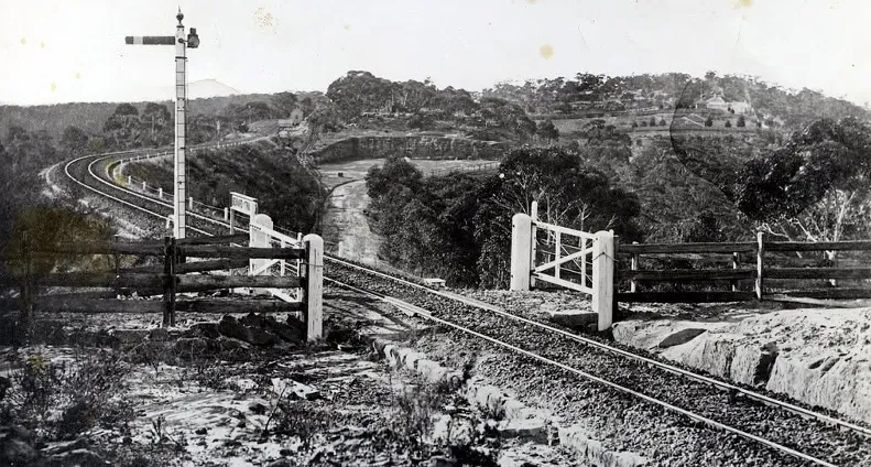
There was an inn at Twenty-Mile Hollow, now known as Woodford, which followed in its design the standard pattern adopted for such premises, being single-storied with hip-roof and centrally placed verandah with end rooms abutting thereon. A large separate kitchen was located amongst the out-buildings at the rear.
About 1.5 km or so beyond Woodford Station lies the celebrated Buss’s Inn, a great rambling structure, mainly one and a half stories high, the upper rooms, clustered beneath the roof, were lighted by windows placed in the end gables and also by a series of dormers. The design of the rear section of the premises was equally fascinating and provided accommodation for a large number of people. The inn was known at one time as the “King’s Arms”, and later came into the possession of Lord Rosebery, a Prime Minister of Great Britain. It then became the Woodford Academy, a high class school for boarding pupils. In 1931 the place was “Closed until further notice”, evidently having fallen victim to the financial stringencies created by the infamous Bank Depression of the early 1930s. It is gratifying in this year of grace, 1972, to see the interesting structure, sheltered by its dense border of trees, more or less intact.
The old established “Blue Mountains Hotel” was sited in the grounds of the Lawson Public School on the left hand side of the highway, a short distance beyond Lawson Railway Station. It is believed that this hostelry opened in 1840 and that the building was single-storied with a shingled roof.
The “Weatherboard Inn”, as its name would imply, was constructed of weatherboards, and sited on the northern side of the original road a short distance to the north of the Wentworth Falls Railway Station. This hostelry was described in the early 1820s as “a very good mountain inn”. It had three parlours, seven bedrooms (of cabin size) and stabling for 17 horses. Across the road from the inn was a large pond which provided water for travelling stock and wagon and coach horses. Traces of this pond may still be seen today, its outlet stream leading to the famous Wentworth Waterfall. The remains of the former inn are now a heritage-listed archaeological site.
At Leura the “Alexandra Hotel” cannot be regarded as having a historic background, but “Gearin’s Hotel”, adjacent to the northern side of the railway level crossing at Katoomba is mentioned in 1886 as being named “Biles’ Hotel” and with a reputation for “the abundance and excellence of the meals served at this establishment.” The “Great Western Hotel”, on the crest of the hill immediately south of Katoomba Railway Station, was built about the same period on “the modern American style”, with a large flat roof adapted for look-out purposes, and some 60 bedrooms. This tourist hotel was later renamed “The Carrington” and still functions as such. The “Katoomba Hotel” is located about 400 m from the level crossing (where a Gothic gatehouse was once situated) and also received mention in 1886 as a wayside inn “Where every attention is shown to visitors by Mrs. Curnow”.
The settlement at Katoomba came into being about 1879 when John Britty North established a coal mine at the foot of the present Scenic Railway. The employees lived at West Katoomba under the usual “mining shanty” conditions. The place name Katoomba, incidentally, is derived from the Aboriginal “Katta-toon-bah”, meaning “Water tumble over hill”, an allusion to the famous Katoomba Waterfall.
About 800 m to the west of the “Explorer’s Tree” and on the northern side of the adjacent railway line, was sited the now long-vanished “Shepherd and Flock Inn”, abutting on the route of the original road in this area, which followed a circuitous course in this area to avoid the flanks of a steep hillside. It is possible that this inn was closed at the coming of the railway when the Bathurst Road was deviated to its present alignment, thus eliminating the need for two level crossings, between which the old inn was placed.
The luxurious hotel at Medlow Bath appears to have been constructed In 1904 by Mark Foy, a Sydney businessman, who took pleasure in naming the place as the “Hydro Majestic”. Additions have been made from time to time to the chaste white buildings and pavilions and the sumptuous appointments are of a very high standard. The avenue of pines and other exotic trees planted along the highway in front of the fenced enclosure is very fine and lead to yet another gatehouse where the original road crossed the railway at a level crossing, now long superseded by an overbridge. The hotel is placed on the clifftop overlooking the Megalong and Kanimbla Valleys. The name Medlow is claimed to be a corruption of the Aboriginal name for the locality “Megalong” meaning “Valley below the cliffs”.
There were at least three early inns functioning at Blackheath, a place name bestowed by Governor Macquarie in 1815, the oldest was named “Gardner’s”, being established by Andrew Gardner in 1830, It had several changes of title in its long and continued history, once being known as the “Hydora Hotel”, later as the “Astoria”, after which the historic name of “Gardner’s Hotel” was adopted. A new facade has been added but portion of the original building is still intact and can be observed from the rear of the present structure. The “Scotch Thistle Inn”, a single storied building dating from 1831, stood on the corner of Govett’s Leap Road and the Great Western Highway. Its hip roof was covered with wooden shingles and the narrow front verandah was flanked at each end by a small room. The inn was later brought into use as Collier’s General Store, a weatherboard building and, about thirty years ago the present “Ivanhoe Hotel” was built on the site. The original “Ivanhoe Hotel” was placed to the north of Clan William Street facing towards Govett’s Leap Road.
Beyond Blackheath the Great Western Highway traverses some 6 kilometres of rugged bush country, a level crossing, and its Gothic design gatekeeper’s residence at One Tree Hill, now known as Mount Victoria. The latter tiny building is still occupied but the level crossing has been replaced by an overbridge. Close by stands the tollhouse, which was built in 1849, the site being adjacent to Broughton’s waterhole. The toll was collected for every animal and vehicle which passed through the gate until the early 1870s when the toll charges were abolished.
A Mr. Sheppeard built the first hotel about the same time as the tollgate was erected, and also conducted a general store on his premises. In 1861 the lease was taken over by William Read. “Sheppeard’s Inn” was, in all probability the most picturesque of the hostelries scattered along the Blue Mountain section of the Great Western Highway. The premises were set well back from the roadway and were fronted by a picket fence backed by a dense hawthorn hedge, whilst the forest encroached on the rear outhouses and formed a lovely background. The shingled roof was later replaced with corrugated iron and several bedrooms were located within the apex of the roof timbers, each having its separate dormer window. The inn premises, although de-licenced for a great many years, was occupied as a residence until about 1940 when it was demolished.
Mount Victoria, formerly known as One Tree Hill, developed into a tourist resort with the coming of the railway and boasted three hotels for this form of business. At 1886 these were listed as Perry’s “Imperial Hotel”, the “Manor House” (a private hotel), and “The Royal Hotel”. The first named, one of the largest out of Sydney, possessed a castellated facade and occupied a commanding situation between the other two places. The previously mentioned Sheppeard’s Inn catered for the needs of the Great Western Road traffic in pre-railway days.
From Mount Victoria the Great Western Highway descends the Victoria Pass leading to Little Hartley, Great Hartley, and beyond to Bathurst and places further west. The road was constructed by convict labour under the supervision of Major Thomas Mitchell and carried out in direct defiance of Governor Darling who favoured another route downwards from Mount York. At the base of the pass is the mountain known as Mount Victoria and nearby is the cone-shaped rise named as “The Sugarloaf”, whilst the ramparts of Mount York border the Little Hartley Valley on the northern side.
The “Victoria Inn” at Little Hartley was built in 1839 and, although now it is a private residence named “Rosedale”, it is regarded as being “one of the finest remaining examples of Australia’s wayside inns”. Its façade is Georgian, or the Australian variety of this form of architecture, and is maintained in splendid order.
About 1.6 km further along the highway, and on the right hand side, is “Billesden Grange”, a former hotel which is claimed locally to have been the second inn constructed by Pierce Collits after his first inn, “The Golden Fleece” had been bypassed by the Victoria Pass deviation. “Billesden Grange” has been in private hands for a great many years and, at 1954, was named as the “Grange” and formed part of the property of Messrs Harris Brothers. Nearby, on the same side of the road, is “The Rose Inn”, built in 1841 by Joseph Collits, and this too is in use as a private residence and kept in excellent order. A fourth inn is Louis Mead’s “Kerosene Hotel”, built in 1857 primarily to cater for the roadside trade then being developed with the installation of the shale oil industry at Hartley Vale. After its closure as an inn the premises became known as “Culver” and at 1972 have been restored and furnished in period style by Mr. and Mrs. William Thurlow. The old name of ‘Mead’s Farm” has been revived and now replaces that of “Culver”.
At the western end of the Mead’s Farm property a byroad leads northwards to Hartley Vale passing beneath the steep slopes of Mount York and then those of Mount Dixon. The original Cox’s route of the first Western Road descended the frightening northwestern side of Mount York as a packhorse track and passed by the military barracks in that area a building which was later taken over by Pierce Collits and opened as the “Golden Fleece Inn” during 1823. This famous inn flourished until the Victoria Pass was opened ten years later, when it was bypassed and lost most of its trade to the “Rose Inn” that had been erected against the new road. It has been stated that a large oak tree which was growing in the grounds was felled to provide a site for a large stable and ancillary buildings. These buildings have recently been demolished, only the main building remains, and this, fortunately is open for inspection at a small charge.
The road continues northward to gain the “Comet Inn” which is now privately owned as a residence. This place stands near the site of the once so extensive oil works which closed about the 1920 period. Here the local shale was distilled to supply kerosene and other products. There was a second hotel at the Hartley Vale village but its location has escaped us. The road, now known as Hartley Pass, ascends to the crest of the Darling Causeway where a junction is made with the Mount Victoria to Bell Road.
Although this essay appears to be concentrated on the many inns strung out along the old Great Western Road it should be stated that these places were very necessary for travellers to eat and find sleeping accommodation in those now far off days. At most of the inns were to be found a blacksmith’s shop for horse shoeing purposes, a post office, and a general store. They provided fodder and water for the animals, horses, cattle, and sheep, passing along the highway, and also relay teams of horses for the numerous passenger and mail coaches. It has been mentioned that many of the land grants made along the route had a proviso that “the tenant build an inn before putting the land to any other use”. Between Emu Plains and Little Hartley the high mountainous region is comparatively sterile from an agricultural point of view and most of the railway stations were located at points adjacent to the small settlements which had grown up around the coaching and other hostelries of yesteryear.
This article was first published in two parts in the June 1972 and July 1972 editions of our magazine.
Browse the magazine archive.