For want of a name I call the small ground birds in Neville W. Cayley’s painting above the carrara marble fireplace in Lydham Hall’s bedroom, Water Hens. I don’t know if they actually are Water Hens for although I have Mr. Cayley’s Book What Bird is That? I have never taken the time to compare the picture with any of the colour plates in this same book whilst I’ve been at Lydham Hall. Perhaps someone else can answer the question of “What Bird” is it in this same painting?
However I have found a little detail of Neville W. Cayley from various sources which I think readers will find interesting.
Neville William Cayley was born January 7, 1886 at Yamba, northern New South Wales and inherited his love of art and birds from his father Neville Henry Peniston Cayley who was an English painter who died in Sydney 1903.
By the time of Neville W. Cayley’s death on March 17, 1950 (aged 63 years) the above mentioned book was in its 14th edition and today is of great value.
Besides producing Our Birds, Our Flowers and The Tale of Bluey Wren he illustrated several of the bird books of naturalist-journalist A.H. Chisholm and painted many colour plates in Dr. G.A. Waterhouse’s What Butterfly is That? He also wrote and illustrated books on budgerigars, parrots, Australian finches and fairy wrens. His main medium in painting was water colour.
Many of his native fauna painting appear in Ellis Troughton’s books of Australian furred animals. In 1932 His Majesty King George V was presented with a Neville W. Cayley painting of Australian Splendid Parrakeets by the London Agricultural Society. A fitting gift as King George owned a pair of these beautiful birds and expressed his warm appreciation for the gift.
In 1924 an exhibition of Cayley’s bird paintings was held at Tyrrell’s Gallery in Sydney. The display was opened by the then Minister for Education (Mr. Bruntnell) who stated that the study of birds was a valuable aid in education and commended Mr. Cayley on his work which would promote the advancement of responsibility of the community toward the protection of these beautiful emblems of flight.
Mr. Neville W. Cayley was closely associated with the Gould League of Bird Lovers, was a member for II years of the National Park Trust, past president of the Royal Australasian Ornithologists’ Union and a past president and fellow of the Royal Zoological Society of New South Wales.
Cayley’s mother (Lois nee Gregory) ran a Guest House at Cronulla where he was a founder of Cronulla Surf Life Saving Club, and he also played a part in the founding of the Surf Life Saving Association of Australia.
Dame Mary Gilmore stated once that he (Neville Cayley) “loves the birds and in the birds, the land of Australia”. Cayley instilled vibrancy into each of his paintings of Australian birds and his technique showed their plumage colours in sunlight and shadow. His detailed studies of birds, their nests and their eggs have been used in encyclopaedias or ornithological treatises and never appear lifeless or uninteresting.
His work was likened to a Swedish painter Bruno Liljefors in that he never over asserted the decorative possibilities of birds in his paintings, many of which included those of Australian coasts, ocean, cliff and beach.
As The Sydney Morning Herald in 1939 stated “brilliant scarlet, blue, green and gold, pale, almost transparent in tint, black and white and silver, indeed as many-hued as they are numerous, the birds of Australia as shown by Cayley form the keynote for the protective colouring with which their haunts enfold them. Paintings of birds by Cayley transform any room in which they are placed into an aviary, a garden sanctuary, or a fragment of bushland inhabited by vital, jewelled, blossom-birds.”
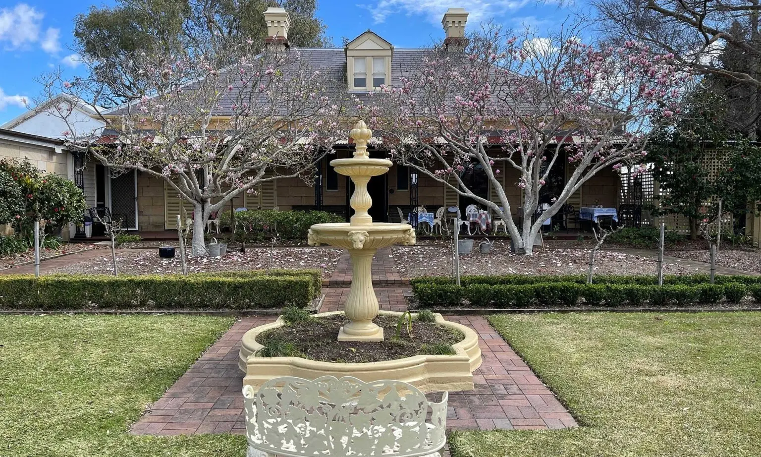
Lydham Hall, an Australian home, is a fitting one to hold a painting of Australian birdlife by the Australian Neville William Cayley. Take a closer look at this exhibit next time you are there.
Editor’s Note: A birdwatcher in the SGHS believes the birds are white-browed crakes (Poliolimnas cinereus).
Sources: The Sydney Morning Herald various copies Australian Dictionary of Biography 1891-1939 Cayley, Neville W. – What Bird Is That: A Guide To The Birds Of Australia Larkin, Maryanne – Sutherland Shire: A History to 1939 NSW Births, Deaths, Marriages Index 1788-1918
This article was first published in the May 2000 edition of our magazine.
With the deviation of the route of the original Rocky Point Road at Arncliffe when the present highway came into being in the early eighteen-sixties, and the Forest Road was extended eastward a short distance from the crest of Cobbler’s Pinch (now marked by the intersection of Somerville Street) to link with the new route, it was thought necessary to install a marker stone as a guide to travellers. This historic stone, which unfortunately disappeared in recent years, was inscribed on the side nearest Rocky Point Road: “TO THE RIVER”, meaning Georges River at Tom Ugly’s Point, whilst the side facing Forest Road was inscribed “TO THE FOREST” (now Hurstville) and “TO KING’S GROVE”. It will be noted that the settlement at King’s Grove appears to be the only one worthy of notice at this particular period.
It is recorded that a small group of timber-getters in search of timber and firewood in the St. George District (once known as Botany Bay) spread out from Canterbury, and as the more lush areas were cleared a close settlement of agriculturists and brick-makers came into being. This rural area gained the name “King’s Grove” after the property so named which was granted by Governor King to Mrs. Hannah Laycock. The best barometer to gauge the progress of any early village is the number of churches, chapels, and inns serving the populace in the area concerned.
In 1841, Thomas Reid advertised for tenders for clearing 200 acres of the original 700 acres belonging to Hannah Laycock. At this time the 200 acres was owned by the trustees of Simeon Lord Estate and was subdivided into forty farms which had much heavy and valuable timber on the estate. The sale was successful, the property selling for £6,000. Thus just preceding the depression of 1842 a whole new class of settlers came to King’s Grove, augmenting the congregation attending church services, and swelling the numbers patronising numerous inns in the immediate area. It may be mentioned that a group of Methodist people had lived about the Moorefield Chapel for many years and that William Lee, one of the leading spirits in the Methodist community, had a grant there as early as 1823. Around Moorefield there were many land grantees.
The earliest church service of which there is any record was conducted in 1841 at Canterbury village by the Methodists (and or Wesleyans) in a temporary chapel in Minter Street, Canterbury, on a half-acre of land purchased from the Sugar Company for £30. It is not certain how long these services were continued.
Moorefield was reported as a preaching place in 1848 or 1849. Services were said to have been held in the residence of Mr. Chard adjoining Evan’s “MAN OF KENT” inn. John Chard gave half an acre for a church site in 1850. The conference minutes for 1851 report that a chapel was being built at Moorefield. Mr. Chard provided the bricks and also helped to build the chapel. In 1851 the chapel was a brick structure 18 feet by 25 feet standing in Moorefield Road. The bricks were made on the adjoining land and the timber for the roof and fence cut at the saw-pit of John Lees. The stone for the window-sills and for the stone name-plate was cut by Mr. Sly, a stone-mason of Newtown who was a brother-in-law of Thomas Chard. In 1851 Reverend John Eggleston reported the chapel was in course of erection. In 1860 the building was enlarged, catering for the new settlers to the district.
We find that at least three taverns carried on business in the King’s Grove area during the early days of its progress. It is recorded that in 1852 the “ROBIN HOOD AND LITTLE JOHN” was owned by Mr. Stephen Bown at Dumbleton (now Beverly Hills) and in 1854 Mr. Evan Evans established the “MAN OF KENT”, a hostelry which adjoined “MOOREFIELD COTTAGE”, the Sharp Street residence of Thomas Chard. A third licence was held by Peter Shannon who in 1858 opened the “CURRENCY LASS” at King’s Grove. The only other tavern trading in the St. George District at about this period was at Wincanton, the early name for Arncliffe, where “THE BOLD FORESTER” alias “THE YORKSHIREMAN’S COAT OF ARMS”, alias “THE SANDS”, located at the north-west corner of Wollongong Road and the present Kelsey Street. There was another tavern, known as “Prendergast’s”, located at the junction apex of Rocky Point Road and Kogarah Road at Kogarah, but unfortunately, precise details of its ownership, or establishment, have so far proved elusive. It is possible that one licensee was named Emerson, a gentleman who subsequently became “mine host” at the “Sea Breeze” Hotel at Tom Ugly’s Point.
Apropos publicans, it is interesting to point out that Thomas Kelsey who pioneered the “Yorkshireman’s Coat of Arms” in Arncliffe to satisfy timber getters at the time of the economic depression about 1841-42 had previously been a publican of a sort at ‘Snugborough Park” King’s Grove, a property belonging to T. Oakey. After leaving the “Yorkshireman’s Coat of Arms” Kelsey took out a publican’s licence for the “Canterbury Arms” in 1847 at Canterbury village. Stephen Bown left the Robin Hood Hotel when Cobbler’s Pinch had been conquered on Arncliffe Hill in 1865, with the opening up of the new road to Tom Ugly’s Point, and took up residence as licensee of the “Gardener’s Arms” sited at the junction of Rocky Point Road and Kogarah Road.
So we may see from the above summary that Kings Grove was a very important part of the St. George District from the earliest times and we would be forfeiting our trust as writers of local history if we did not pay recognition to Thomas and John Chard, William Lee, the Hancock’s, and other early settlers in this short essay. Thomas Chard was a member of the Forest Road Trust, together with Michael Gannon, P.A. Thompson, F. Unwin, amongst others, when Stoney Greek Road joined Forest Road in the route from King’s Grove to Bexley in 1849.
This article was re-published in the May 1971 edition of our magazine.
The early settlement of the Kogarah district largely followed the route of the old established Rocky Point Road, which, as a rough bush track, had been constructed to the order of Governor Sir George Gipps, about the 1840s. The region was devoted to market gardening and the cultivation of orchards. The Sydney Morning Herald of February 2nd, 1878, published a paragraph relating to Kogarah, which conveys a vivid word picture of the local scene at that particular period and we have taken the liberty of quoting the article in full. It reads as follows:
“One of the prettiest though perhaps one of the least known roads out of Sydney, is that which goes beyond Cook’s River Darn to Kogarah, Sandringham, and Sans Souci. But few persons are aware of the natural beauty of the scenery at different parts of the road. The forest at the present scene of drought is clothed with verdure, very refreshing to the eye. Trees, familiarly known as the Gum, Black-butt, Swamp Mahogony, Forest Mahogony, Wattles, Acacias, and ferns, flourish in perfection; and in places show a mass of foliage almost tropical in its luxuriance. The valleys are for the most part covered with market gardens, which, notwithstanding the dry weather, are well supplied with vegetables. Though little rain has fallen lately, there is a good supply of water, which gives them a fertility which few other localities possess. The soil is black loam and sand, and being well manured, its richness is perpetuated in the driest seasons. In fact, it is at such times that the gardeners here reap their most profitable harvest. The moisture retained in the sand ascends in drought and nourishes the surface soil, and is productive to a remarkable extent when vegetation elsewhere perishes. Hence the good crops of cabbage, pumpkins, vegetables of all kinds, which now cover the ground. Splendid heads of cabbage and fine specimens of pumpkins lie over the gardens, and furnish the owners with supplies several times a week for the Sydney market, the return trip being utilized by the carrying of loads of manure to sustain the fertility of the soil. Many of the gardeners give the ground an occasional dressing of guano, and this further stimulates the fertility and they are amply rewarded for their outlay. The natural grass, tolerably fresh; and cattle; which find in it their entire sustenance, seem in fair condition. During the day there is generally a delightful sea-breeze blowing from Botany Bay, which is about half a mile away. The road itself is classed as one of the main roads of the colony, and receives an annual vote of £50 per mile. Formerly a portion of the money derived from tolls was expended on its repair, but the abolition of these will probably necessitate the raising of revenue for road purposes in some other way, as the annual vote is considered too small to maintain the road in decent order, the traffic in it being very heavy. Several new houses are in course of erection and freestone is available in the locality, there being a quarry on the roadside. The inhabitants are now endeavouring to secure a railway in the hope of converting it into a suburb of the city.”
With this introduction in mind, we will in the ten year period ranging between 1895 and 1905, visit Kogarah from the direction of Rockdale, walking southwards along the ancient highway. Approaching the bridge over Black, or Muddy Creek, can be seen on our left hand side, the tree-lined driveway leading to the fine old home of Mr J.P. Lister, bearing the quaint name of “Hayburn Wyke”. The residence, (which has now been converted into flats and modified accordingly) faced towards the creek, and it would appear that the property was formerly orchard land, which extended southwards to the creek and followed Rocky Point Road on its western alignment. At the time of viewing the land was a wilderness of weedy-growth inter-mixed with the broad- leafed foliage of castor-oil trees, the presence of a single persimon tree marking the old-time orchard. This tree carried a magnificent crop of fruit, a circumstance well known and appreciated by the writer in his more tender years, and also by his mates, whose method of approach was to walk along the bed of the creek, and then crawl through the long grass until the tree was reached. Here a watchful eye was kept on the inhabitants of “Hayburn Wyke” while the other eye scanned the branches for fully ripe and luscious fruit.
On the opposite, or right hand side of Rocky Point Road, was a hedge of sweet-scented orange and yellow flowering Buddalea, which marked the roadside border of an extensive Chinese market garden. These Oriental gentlemen lived in a rambling head-height hutment composed of sundry odd-shaped pieces of galvanised corrugated iron, held together in a purely functional manner, designed to give protection where most desired from wind and rain. These shanties were always a joy to artists and a nightmare to orthodox-minded aldermen and their cohorts, such as building inspectors and inspectors of nuisances. Adjacent to the hut was a small grove of sacred Tree of Heaven plants, and several spiky growths of New Zealand Flax, the leaves of which were split into strips to form binding for bunches of carrots, parsnips, turnips, spinach, and other vegetables which needed stringing together for selling purposes.
The western alignment of this garden was bordered by the banks of the small watercourse which drained the eastern hillslopes of Bexley in the vicinity of Frederick Street. The garden side of the creek was distinguished by a fine row of high, but somewhat spindly pine trees (pinus insignus) which formed a windbreak from the prevailing westerlies. The southern end of the well-kept garden lay against the tranquil waters, at times, of Black Creek, which hereabouts was also known as Skidmore’s Creek, the land being “fenced” by a wild growth of pink-flowered lantana, which, in turn, gave full protection against nefarious visits of vegetable thieves and prospecting schoolboys.
In the course of their unlawful occasions the latter youth group wormed their bare-footed way along the creek bed at the western side of the market garden to a point opposite the marrow bed. Small young marrows, slit down the middle and the innards scraped out, made two excellent model boats to sail on Black Creek, sails being devised from pieces of cardboard suitably cut to shape. John Chinaman had other views, apart from nautical ones, on the subject, should said youthful but aspiring mariners be sighted from the residential shanty, he would gather his assistant gardeners and turn out enmasse, armed with and brandishing hoe-handles, devilish long-pointed pitch-forks, screaming threats and, no doubt, suitable insults, in a language incomprehensible to the young offenders, who in turn, lost no time in beating a hasty retreat to the sanctuary of the creek bed, then hot-footing it home to safety.
There is reason to believe that this particular Chinese garden was formerly occupied by Mr. Frederick Skidmore, who apparently sold the property to the Orientals in the late 1880s. Mr. Skidmore occupied a group of three brick single-roomed houses, built in close proximity to each other, on the southern bank of Muddy Creek and immediately adjacent to the Rocky Point Road. According to Mrs Mitchell, of Harrow Road, Kogarah, this homestead was reputed to be the fifth residence built in the St. George District south of Cook’s River. In general design the kitchen, together with a small subdivided bedroom, formed the oldest part of the building group, and was reminiscent of an Irish peasant’s cabin of County Donegal. Entrance from the yard into the kitchen was gained by passing through a pair of half, or Dutch type, doors let into the northern side wall. This arrangement served a double duty, firstly, by keeping the lower half-door closed, the unauthorised entry of poultry and live-stock was prevented, whilst the opening of the upper half door permitted maximum daylight and fresh air to enter, and also, under certain weather conditions, let the smoke escape from the open fire place.
This huge fireplace, built of brick, occupied the greater part of the width of the western wall of the kitchen, and its burning logs must have furnished a cosy warmth in the chill days of winter. One can picture the pots, pans, and kettles, dangling at the end of their respective lengths of chain, suspended over the crackling flames. Nearby would be the woodbox full of burnable material and against the southern wall would be the open-fronted dresser laden with Staffordshire crockery of the more serviceable type. In odd nooks and crannies would stand spades, mattocks, hoes and other valuable farm equipment, stored for safety in this domestic sanctum.
The other two separately roofed rooms, of much smaller size than the kitchen, no doubt were used as bedrooms to accommodate the needs of an increasing family. In later years the Skidmore homestead was occupied by the elderly Mrs Lennis and after her departure, or demise, the buildings fell into ruin and were demolished about 1930. The site of the Skidmore farmhouses can now be determined by the modern residence which is numbered 611 on the Princes Highway.
Proceeding up stream along the southern bank of Skidmore’s Creek at the time under review, a notable landmark was met in the form of a huge gumtree, a lone survivor of the age-old forest which once covered the land. This particular tree carried a large placard, in its lower branches, which read “Woodman Spare This Tree In Memory Of Poor Old Charlies Barsby”. The reason for this singular notice has not been ascertained, and old residents were non-plused as to the whys and why-fors of its presence. The tree, of course, was not spared.
Abutting on to the site of the just mentioned gumtree was the farm and residence of another branch of the Skidmore family, the brick house facing towards the then unmade continuation of Harrow Road, where it crossed, by means of a narrow width footbridge, the muddied waters of Skidmore’s Creek. The single storied double-fronted cottage conformed to a pattern, evidently designed by a local builder, as other examples of similar residences were erected on farms nearby, and one as far away as Wazir Street, Arncliffe.
On the opposite side of Harrow Road, facing towards what is now known as Railway Parade, was the property of Mr. Fry, which carried an excellent orchard of loquats, pomegranites, peaches and other fruits, attractive commodities which kept the owner of the orchard very busy and war-like during the ripening season, for reasons that are obvious and better not stated. The creek at the rear of the Fry property, known locally as Fry’s Creek, was completely overhung by a dense row of the water-loving quince-trees, whilst the opposite, or northern bank was enshrouded in an equally high tangle of lantana and other rough growth, a most attractive bird-haunted area. The still waters beneath this sylvan splendour were the home of large eels and numerous small tortoises, all of whom were too wise to succumb to the alluring worm used in conjunction with a bent pin and a piece of thin string. In latter years the Fry estate was taken over by Kogarah Council and adapted as a nightsoil reception depot, a necessary amenity which did not endear itself to the local residents. The glamour of Fry’s Creek was replaced by a large stormwater channel and, fortunately, somebody has been wise enough to furnish a side planting of willow trees which have grown into magnificent examples of their kind. Strangely enough, so far, they have avoided being butchered to stumps by the municipal axe.
Retracing our steps to Skidmore’s Bridge, which incidentally, was constructed in 1862, replacing a water splash which created a serious traffic hazard when the creek was in spate, our journey continues southwards along Rocky Point Road. At the left hand side is the extensive market garden, acknowledged to be the best in the district, owned by Mr Reuter. This gentleman was famous for his Shanghai peaches and also for the size of the mulberry tree, which grew near his fine double-fronted residence named “Ashtonville”. These premises were in good repair at November 1964, but at that period the house, listed as No. 646 Princes Highway, was advertised for sale. The market garden had been operated for a number of years by a group of Chinese, but has recently been levelled and subdivided into housing allotments, a large portion of the area being incorporated in the modern shopping centre grandiloquently called the South Side Plaza.
Opposite the former Reuter home, and on the right hand side of the Princes Highway is No.619, a longish single-fronted shop which, at one time, was said to be a Free Church. However, at the time under review the premises housed the Small family. Then came, in close juxtaposition, a row of cottages which, greatly modified, are still in occupation, one in particular being conspicuous be a nearly full size model of a white horse, raised above an entrance gateway, denoting to all and sundry that a veterinary surgeon lived on the premises. The last house of this group, No.643, was occupied by a school teacher who at the time was attached to Kogarah Superior Public School. A vacant block of rocky land, now levelled and in use as a service station, reached southward to the apex formed by the intersection of Rocky Point Road and Harrow Road. In the latter thoroughfare facing towards the road junction is a row of small cottages, built in a variety of designs which were mostly in evidence at the time of our visit.
Opposite the Harrow Road Junction was the farmland of Mr. Chandler which has suffered subdivision into a housing estate, the name of the former owner being perpetuated in Chandler Avenue, which abutts the Highway. Opposite to the intersection of Stanley Street, is the large single storied residence, No.672, formerly occupied by Mr Hepple, a successful local bookmaker. On either side of Stanley Street were small general stores, built of brick, one of which, No.11, after serving for some years as a second-hand mart, has recently been replaced by a modern building. The other shop, No.13, still functions as the Malford Pet Foods establishment. The adjacent two-storied shops, southward from the intersection of Stanley Street, are of more recent origin and one came into use as a grocery store about 1910 or so. From these shops southward to Regent Street, was the road frontage of a large grass paddock, without fence, which eventually underwent subdivision and is now covered with cottages.
Crossing Regent Street, the first building to be met was the Oddfellow’s Hall, locally known as the “Blood house” owing to the “free for all” fight which often occurred on the premises when let for public meetings, weddings, etc. The main structure of this edifice still exists and can be observed, with its high brick-faced gable and circular vent insert, from a position a little along Regent Street. The facade of the old hall has been masked by a pair of two-storied shops, although the main hall retains its separate access, as No.45, and is in the hands of the Yardstick Curtain Company.
Still keeping to the western side of the highway we would find that a small and neat double-fronted brick cottage, next door to the aforementioned Oddfellow’s Hall, was occupied in the 1905 period by the Powys family. Then came St. Paul’s Church of England Rectory, which later fell on evil days in the hands of a carrying company has since been demolished, the grounds being subsequently utilised as a play area for school children. The Sunday School Hall attached to St. Paul’s Church now comes into line, a prosaic building of no artistic merit.
St. Paul’s Church is really an historic building, the first portion, comprising the nave, being erected in June 1869 and dedicated by Bishop Barker in September of the same year. It stands on land donated as a church site by Mr. Wolfen and the structure, built of stone and roofed with wooden shingles, was erected by Mr. Bush. A sanctuary was later added which contains four beautiful stained glass windows, the gift of the Bowen family. Large side and organ vestries were added during the ministry of the late Reverend Stanley G. Best.
The Reverend John Done was the first incumbent, and on his decease his remains were interred in the cemetery located between the Church building and the frontage of the Church lands which formerly faced Gladstone Street. Many of the pioneers of the St. George District were buried at St. Paul’s Graveyard and the last burial was that of the late Mrs. Wilkinson, of Belgrave Street, Kogarah, during the early portion of the ministry of Reverend Stanley Best. The area was eventually resumed by the Department of Education as a play area for school children, the headstones being re-sited at the rear of the St. Paul’s Sunday School. A new rectory has been built on Church land immediately south of the Church. Beyond the boundary fence, at the supposed time of our visit, was a triangular shaped piece of unfenced vacant land which reached southwards to terminate at the intersection of Gladstone Street and Rocky Point Road.
Retracing our steps to the intersection of Regent Street, and crossing over Rocky Point Road before again heading southward, we reach a pair of well built shops, the first a general store, No. 692 and the next, No. 694, was the old established produce and chaff store owned by Mr. Harry Soames. These buildings were typical of the 1885 period and, unfortunately, both have been demolished in recent years, the land which they occupied lies vacant and is covered with sundry demolition rubbish. Crossing French Street we reach No. 708, a two-storied residence now sadly modified, which was formerly in the possession of Mrs. Hegarty, a sister of Mr. Peter Moore of Moorefield Racecourse fame.
Next in line is the old established jam factory, No. 714, owned by the Ambrose family. These premises have been greatly altered insofar as their frontage to Rocky Point Road is concerned. The old shop at the corner of Green Street was built by Mr. Sugarman who practiced his profession as a glazier, whilst his good wife helped to gain sustenance by regularly milking a herd of goats which roamed the neighbourhood and ate whatever came their way, be it grass, cardboard or old tins. The animals showed a particular preference for browsing in well kept flower and backyard vegetable gardens. Mr. Sugarman was of Jewish persuasion and delighted in having a pot at the nearby Moorefield Hotel, but was not so delighted according to a local report, when a stray match set fire to his beard and sent the lot up in smoke, a burnt sacrifice if ever there was one.
Between Green Street and President Avenue was a large block of unfenced land which served the local foot-loose horse and goat population with ample nourishment. Across the President Avenue was the long frontage of the Moorefield Racecourse, broken only by the short continuation of Hogben Street, which formed the entrance to the course and the adjacent two-storied Moorefield Hotel which had been built by Mr. Peter Moore. Also enclosed within the racecourse grounds and hidden from view by a ten feet high paling fence, were two small stone built cottages, obviously of great age, but their history has proved elusive. At the southern end of the course frontage is a group of three cottages, each of which could well date back before the turn of the century, and each of which is in a good state of preservation.
Reverting back to the intersection of Gladstone Street and following along the western side of Rocky Point Road, in a southerly direction, we reach a triangular block of land with a building flanked by peppercorn trees. We have no clue as to the vintage of owner of these premises but believe that he was greatly interested in racehorses. Then came a group of about five small single-fronted cottages built to the order of Mr Peter Moore, one which survives, is named “Bega” and another “Milton”. Next door to this row was a blacksmith’s shop, then came a general store, and the imposing two-storied building at the corner of Hogben Street, according to local tradition, was the Kogarah Branch of the Bank of Australasia. For a great many years these premises have been, and still are, utilised as a mixed business store.
Crossing Hogben Street and a long vacant piece of land, which, if my memory is correct, was once occupied by a small weatherboard cottage, and later by a bottle yard, we arrive at the blacksmith’s and farrier’s chop of Mr. Killick. Hard against these premises was South’s general store and bakery, an old established business managed, over a long period by at least four generations of the South family. It was here that, in pre-railway days, one caught Mr. Lowe’s horse-drawn omnibus when going to Sydney Town, and also posted and received one’s mail. The shop was the centre of activity for the rural community for many miles around. Continuing over the obviously named South Street, we pass by a large fenced paddock in the middle of which was a small cottage, the ownership of same has not been traced as yet. This paddock eventually came into the possession of the St. George Cottage Hospital authorities about the year 1893.
Next door to the paddock just mentioned was the small stone church, built in 1865, by Mr Walz of Rockdale, and known as St. Patrick’s Schoole. The title was chiseled into a headstone beneath the eastern end gable and evidently the misspelling of schoole was pointed out to the mason as an ineffectual attempt had been made to chisel out the offending “E”. An ancient graveyard surrounded the sacred edifice of which traces remain, although the old school building, which also served as a church, has long been demolished. The present church, also known as St. Patrick’s, was built in 1887 when Father Byrne was priest in charge of a parish which extended between Cooks River and Sutherland and as far west as Canterbury. A rather unique tower has been added to the church fabric in which hangs a deep, mellow toned bell, said to have been cast in Ireland.
Passing by two old established cottages we reach the site of Prendergast’s Hotel, situated at the junction of Kogarah Road and Rocky Point Road. This ancient hostelry went out of business about 1863, and is regarded as being one of the oldest inns in the St. George District. It would appear that the site was later occupied by Beaver’s Gardener’s Arms Hotel, a large two- storied structure, which in turn went out of business about 1911 under the terms of the No-license Act of that year. The building then became a general store , in latter years was taken over, and subsequently demolished, by the St. George League’s Club preparatory to the erection of a new clubhouse. It is interesting to note that the first meeting of the then newly formed Kogarah Municipal Council, held on March 9th, 1886, took place at the old Gardener’s Arm Hotel.
Having reached the parting of the highways we will conclude this rambling essay with a quotation from the Kogarah Municipal Jubilee Handbook of 1935, to wit. “Records show that Kogarah has sometimes been spelled “Koggerah”. “Koggrah”. “Koggarah”. and frequently minus the final “h”. An Irish gentleman who viewed the district for the first time was heard to say “Kogarah, Kogarah”. It must be a Celtic word though I have never heard it before. It has a good old Irish rowl about it.”
These reminiscences have been culled from personal experiences of the authors and the able assistance of Miss Elizabeth Whitehall, a resident of some eighty years standing in the Kogarah area. Mrs. Mitchell and Mrs. N. Wakefield have also helped in giving information which has proved must useful in the compilation of the text. There are, no doubt, many errors and misspelling of names in the script, but, by and large, the story is a truthful account of by-gone days along the stretch of ancient highway between Skidmore’s Bridge and the Gardiner’s Arms Hotel.
This article was first published in the February 1965 edition of our magazine.